Showing posts with label Bahamas. Show all posts

Saturday, October 4, 2014

Inventor Cruisers

Rob & PJ’s trawler “C” Y A

At Pete’s Pub in Little Harbour, Bahamas we met Rob and PJ over sundowners.  They were cruising and fishing - mainly fishing the Bahamas.  Looking at Motivator, Rob said I bet you have a few RACOR fuel filters on that boat.  I responded yes, six to be exact.  He told me he invented FilterGuage®, a product that would tell me when to change the fuel filters. 


I said I had gauges on the RACORs for the main engines.  He responded that the ones I have are notoriously inaccurate even when you read them correctly, and that he would give me one of his to try.  After a little research, I determined that I indeed was reading them incorrectly.  After starting the engines, I would do an engine room check that included a glance at the RACOR gauges.  To tell you anything, the gauges must be read underway with a full load on the engines, not at idle.


The next evening, Rob gave me a FilterGauge®.  The big advantage of Rob’s gauge is that you can read it with the engine off.  It registers the highest filter contamination level until reset.  It is reset simply by pressing the button on the top.


When the yellow indicator inside FilterGauge® is at the bottom of the green area, change your diesel filter and push the reset button.  Do not wait for the indicator to be in the red!  Rob was able to demonstrate this to me at the bar by sucking on the bottom of the T-handle.


I gave the FilterGauge® a test run on Motivator’s small generator.  Removal and visual inspection of the filter when it reached the red (above) confirmed its accuracy.  Damn, he only gave me one.  Now I have to order more from Defender Marine.

Abby & Steve on Who Cares

Another inventor cruiser we have met is Steve Skulnick on E-dock here in New Bern, NC.  Several years back, Steve invented the Freedom Fender after watching regular fenders slip off when used against pilings.

The Freedom Fender eliminates the need for fender boards

The Freedom Fender is concave on one side so that it stays centered on the piling.  In 2004, Steve licensed his patent on the Freedom Fender line to Taylor Made Products so he could go cruising.  The Taylor Made Freedom Fenders are available at most chandleries.  Motivator’s crew was wishing we had a couple when we were sliding off the piling during Hurricane Arthur.


Soon after purchasing Motivator, I cable tied a yardstick to the fuel tank sight tubes.  On the upper three quarters of the tank they give a fairly accurate reading of the fuel status.  With the yardstick cut off at the 35” mark, one inch equals 10 gallons on our 350 gallon tanks.  I wonder if I can get a patent on this?

Sunday, June 29, 2014

Storm Chasers


From Green Turtle Cay in the Bahamas, we elected to do a 25 hour crossing to the Fort Pierce inlet and then up the Intercostal Waterway (ICW) to Vero Beach, Florida.  We could have broken up the trip with stops at Great Sale Cay and the West End, but we decided that we had a good weather window.  Also, the timing worked better for making the inlet and the ICW in daylight hours.


The first half of our trip crossing the Little Bahama Banks was grand.  Perfect conditions for a crossing.  Wind was less than 5 knots and the waves were less than 2 feet.  At nightfall conditions started changing.  After 2 ½ years down island, we had mostly forgotten how severe thunder storms that form over large land masses can be.  Dodging container ships and large tankers at night while in heavy rain and strong winds can be somewhat stressful.  But, that was not our biggest concern.  Lightning bolts as big as Sequoia trees were!


Our radar displays the storm cells for us nicely.  The problem is trying to maneuver around cells building and moving at 25 knots in a 7 knot boat.  After a couple of unsuccessful attempts it became apparent we were storm magnets.


Motivator once again proved that she can take more than us and brought us safely back to the USA.  Unfortunately, our thunderstorm magnetism continues as we work our way north.  

Sunday, May 18, 2014

Replay Value

Warderick Wells Cay North Mooring Field

Certain movies like Captain Ron, with Kurt Russel you can watch more than once.  Other movies like Cut Throat Island, with Geena Davis are hard to sit through the first time.  We say movies like Captain Ron have “replay value.”  Islands are the same way.  Some you want to visit more than once, while others not so much.


One place that certainly has replay value for us is the Exuma Cays Land and Sea Park.  Fifty years-ago, a twenty-two mile stretch of the Exuma Cays was set aside as a reserve.  It is a no-take zone, meaning no fishing, shelling, conching, or lobstering is allowed within the park boundaries.


It seems most of the park’s creatures know the rules.  The lizard above was happy to pose for the camera.  On previous trips we saw huge lobsters waving their antenna as us as if to say, “Niener-niener-niener, you can’t touch me!”

                                                           Source: Wikipedia

We even had a visit by one of the island’s hutia at a beach cocktail party.  You are not supposed to feed the wildlife, but the little guy we saw appeared to be accustomed to begging food from cruisers.


While we did not seem to intimidate the park’s smaller creatures, some of the larger ones intimidated us.  I was attaching the dinghy’s towing harness to the lower pad eyes, when Pollie noticed we had a visitor.  Please note how close the pad eyes are to the water.  The shark swam around inspecting our towing harness, but then lost interest when I was no longer sticking my hands in the water.


Hiking the well-marked trails on Warderick Wells is always an adventure.


We did find out, however that their estimation for the length of time a trail will take is a little on the optimistic side.  Evidently they had timed a mountain goat making his way around.


 Pollie found the hike exhilarating.


While I found a bench perfect for communing with nature while enjoying a cold beer which Pollie carried for me in her backpack. 

This outfit should scare the sharks away!

It is a land and sea park.  Besides hiking trails the park boasts great areas to snorkel.  A variety of sea life can be observed, and near Cambridge Cay they have their own sunken drug plane.


The crew of Izzy R told us about a feature not on the official park snorkel guides.  A sunken wreck between moorings number 9 and 10 in the north mooring field.  That was handy because we were assigned mooring number 9.


The Exuma Cays Land and Sea Park definitely has replay value!

Friday, May 16, 2014

Pink, Blue and Yellow Stores


Motivator’s next stop after The Marina at Emerald Bay was Staniel Cay (cay is pronounced key) for light provisioning.  Almost everything in the Bahamas is imported, so there are shipping costs and stiff import taxes added to all products.  We therefore try to bring everything we will need especially snack foods and toiletries which seem to be very pricey


From Emerald Bay to Staniel Cay we elected to travel on the “outside” because the wind was out of the west.  After two years in the Caribbean easterly trade winds, wind out of the west seemed strange.  Throughout the Bahamas shallow draft boats usually have the choice between traveling in the protected water of the banks, dodging skinny spots and coral heads, or cruising outside in the exposed deep water.

Pigs receiving restaurant scraps

The first night Motivator anchored on the east side of Big Majors Spot. The next morning the wind started clocking back around north to east.  We then moved to the west side of Big Majors Spot off “Swimming Pigs Beach.”  The first time we were here, we took our dinghy over to the beach, only to discover that the swimming feral pigs are rather large and somewhat aggressive.  Pollie says, “They have stinking breathe, big gnashing teeth and huge gaping maws!”


In the Caribbean where we were usually the only motor yacht in the anchorage. At Big Majors Spot we counted nine motor yachts.  The “stink boats” outnumbered the “rag hangers.”


The only provisions we really needed were salad supplies, lettuce, tomatoes and cucumbers.  Of the three, lettuce is usually the hardest to find in the islands.  We elected to start with the “yellow store” which is best approached by dinghy.  At approximately 800 square feet (two car garage), it is the largest of the three stores.  On the way there, we passed Tida Wave, one of the winning Bahamian sloops at the Family Islands Regatta in George Town.  The “yellow store” was a strikeout on lettuce.


The other two stores have to be approached from land.  It is best to park the dinghy at the Staniel Cay Yacht Club and walk the coast road to the “pink and blue” stores.  On the way there, we discovered that we had missed the local farmers market by only a couple of days.


Signage for the stores is somewhat lacking, but we knew the way from previous visits to Staniel Cay. 


The “blue store” comprises of about 600 square feet with one cooler and one chest type deep freeze.  We were pleased to find the “blue store” was under the next generation of management.  It was cleaner, better stocked, and prices were clearly marked.  It had lettuce!


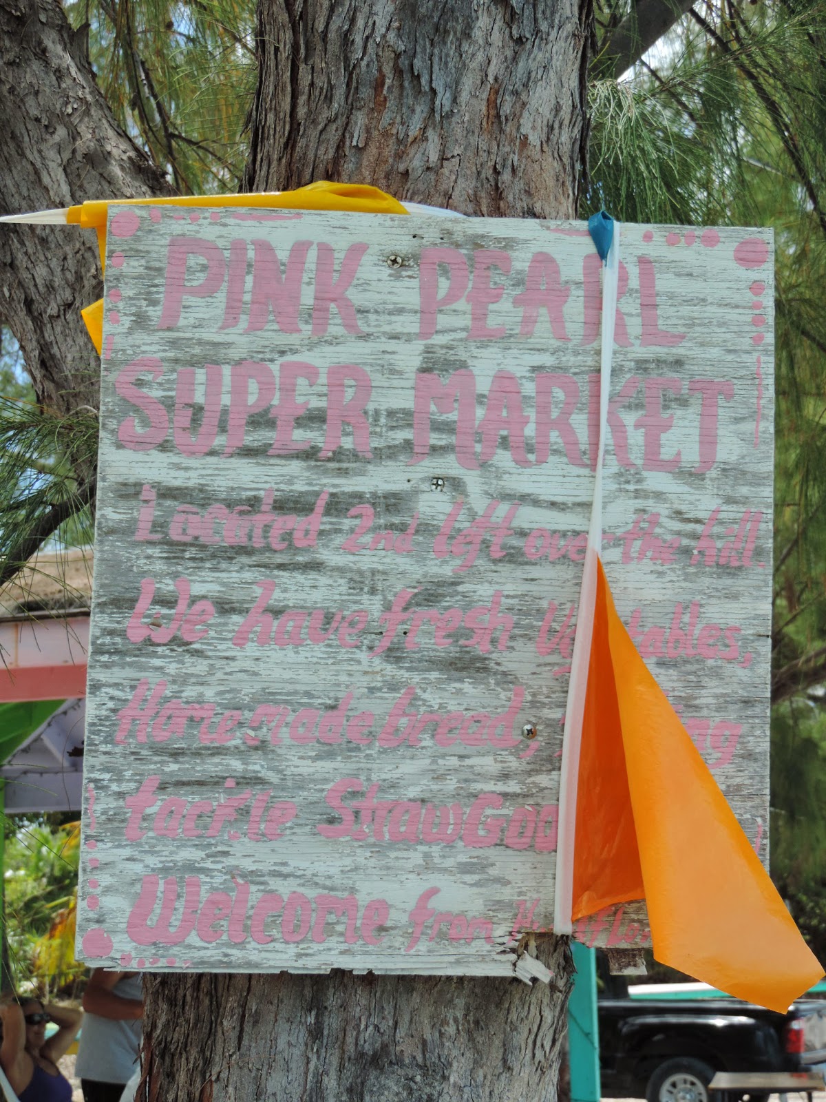
With our lettuce in hand, we skipped the “Pink Pearl Super Market.”  Last time we visited the prices were not marked and at checkout the total was exorbitant.  Also, the pot smoking grandmother at the cash register tried to short change us.  We did notice that her house had been restored.  Last time, two years ago, she announced they were waiting for money from the “government” to repair hurricane damage. 

Wednesday, April 30, 2014

The Family Islands Regatta

Coconut Harvest Event (March 2011)

March brings the mayhem of The Cruising Regatta to Elizabeth Harbour and Stocking Island in the Exumas.  After many of the 500 or so cruising boats anchored in Elizabeth Harbour disperse to other parts of the Bahamas, it is time for The Family Islands Regatta.  Proceeds raised from The Cruising Regatta helps George Town put on The Family Islands Regatta each April. 


After the abolishment of slavery, many of the then failing plantations were deeded to the freed slaves who often took the surnames of their previous owners.  These “families” took on administering their own islands.  “The Local Government Act” of 1996 formalized the process.  Today there are 38 districts or Family Island Administrations.


For the Bahamas, The Family Islands Regatta is the World Series, Super Bowl, and World Cup all rolled into one.  It began in the 1950’s as powered boats were replacing the Bahamian working sail craft and many wanted to save the traditional boats.  In 1954 nearly 70 Bahamian sloops, schooners and dinghies gathered in Elizabeth Harbour for sailing and “related” activities.


The early contestant’s boats were working vessels, but as rivalries and prize money increased newer boats designed solely for racing began to appear.  Today, Bahamian sloop racing rules are clear.  The boats must be designed, built, owned, skippered, and primarily crewed by Bahamians.  The length (LOA) must not be more than 28’3”, sails must be canvass, the hull made of wood, and the single wooden mast must not be bent.  No bowsprits, spreaders, winches, or any sort of a wind instrument including tell-tales are allowed.


Because these boats were initially designed as working boats for the shallow Bahamian waters, they do not have the deep keels or ballast.  Instead they rely on prys, wooden planks that crew members extend out on the windward side and then climb onto.  Tacking can be a real challenge on the triangular race course and sometimes crew members are lost overboard.  However, any boat that does not stop for a MOB is disqualified.


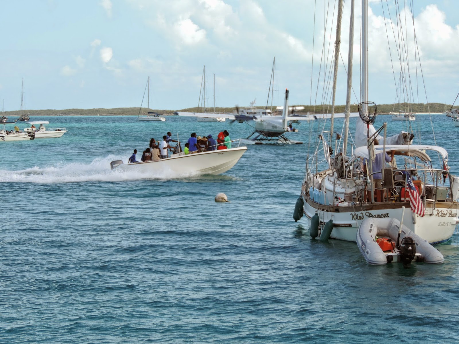
Spectators are allowed to follow the action in dinghies and other boats.  Sometimes there appears to be more spectator boats than racing sloops.  We watched from the safety of the back deck of our boat because I do not think they are required to pickup spectator MOBs.

Picture ceremony on one of the wining boats, Tida Wave

Cruising friends advised us that the music from the Government Dock lasted until 4:00 AM on the Friday night before the end of the regatta.  Celebrations were much more subdued on the last night of regatta.  Chat n’ Chill was hopping, but that is normal.


Then on Sunday the regatta was over and everyone headed home to prepare for next year.

Tuesday, April 29, 2014

Bahamian Island Hopping


After spending a relaxing, but expensive few days in Providenciales, (“Just say Provo, mon, don’t hurt your tongue.”) Turks & Caicos Islands (TCI), it was time to move on.  TCI has evidently ran up some debt that they are attempting to pay off through taxation.  As one observer noted, they only seem to have two industries in the islands, religion and tourism. 

 Solo Tu passing us

We had met some of the crew of Solo Tu a 101’ private yacht also headed for the Bahamas in Turtle Cove Marina in TCI.  Although they departed behind us, they soon passed by.


With no wind and very little swell the 56 NM to our first Bahamian island, Mayaguana, was very pleasant and uneventful.  As far as we could see, Mayaguana’s highest and best use today is the reef protected anchorage at Abraham’s Bay for boats arriving or departing the Bahamas.  It does have a government office where cruisers can check in next to a Bahamas Telecommunication Corporation (BTC) office with SIM cards for your phone.


After the long night crossings required between Turks & Caicos Islands, Dominican Republic, and Puerto Rico, it is nice to get back to island hopping.  Motivator’s crew prefers 50 to 60 mile legs with a nice anchorage to enjoy a sundowner at the end of the day.

Umbrella Rock marking the entrance to Attwood Harbour

One such anchorage is Attwood Harbour in the Crooked Island District.  The sailing vessel Sea Gem arrived soon after us.  We had briefly met her crew in TCI, so we enjoyed conversation and sundowners with them.  We were the only boats in the anchorage.

Rigging the anchor bridle in Attwood Harbour

One of our guide books say that Attwood Harbour is a “deathtrap in a norther,” and that is probably true.  However, both times we have anchored there we found it to be a quite pleasant.

Sea Gem at sunset

The next morning we beat Sea Gem’s crew out of the anchorage.  We did watch them on the AIS as they also headed for Little Harbour on Long Island.

AIS target on Motivator’s chart plotter

Other targets on the AIS were watched more closely.

Genco Thunder

Using the AIS presentation we were able to determine that a slight port turn would allow us to pass a mile behind the tanker instead of three tenths of a mile.  Pollie says, New Rule, we miss these guys by at least a mile.

Typical Bahamian Beach

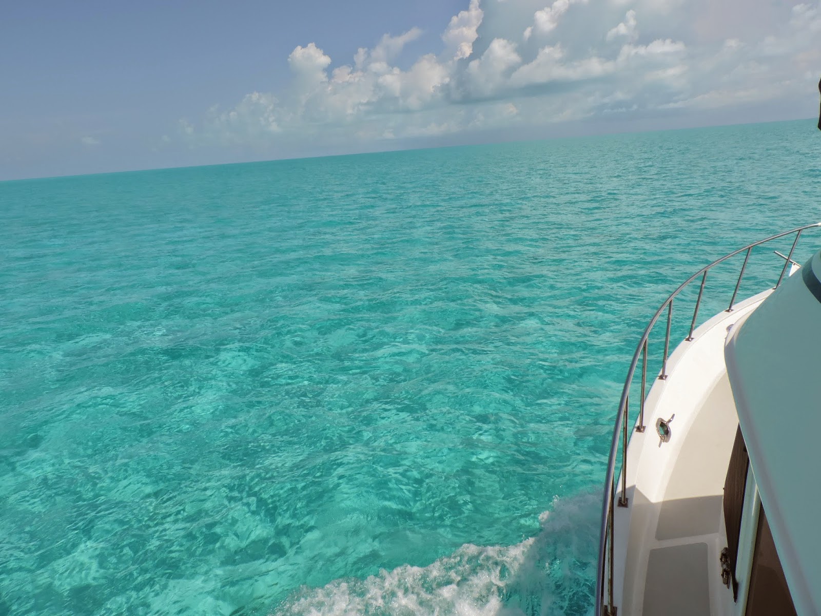
Unlike the volcanic islands in the Caribbean we spent two years with, the Bahamas are mostly low lying lumps of limestone.  While the land masses are not as dramatic as in the Caribbean, the water is spectacular. 

The sometimes working lighthouse on Bird Rock

On the northeast tip of the Crooked Islands is a 112’ limestone lighthouse that is probably the highest point in the southern Bahamas.  I once asked a professional captain about the feasibility of moving at night in the Bahamas.  He said, “There are two types that move at night, fools and drug runners.”

Sandy Cay at low tide

After spending a pleasant night at Little Harbour with three other boats, we went around the southern point of Long Island and into Dollar Harbour.  Dollar Harbour is not your typical harbor.  At low tide there is sand around you.

Sandy Cay at high tide

The “landscape” changes somewhat at high tide.  Although you know that you are in shallow water, it feels like you are anchored in open water.


Evidently the bone fishing is good.  These day trippers seemed to be enjoying themselves.

S/V Fussel

Again the neighborhood was not crowded.  There was only one other vessel anchored in Dollar Harbour.


The next day we spent crossing the bank between Long Island and Great Exuma.  Most of the day we had 6’ or less under our keel.

Motivator’s course

We decided to cross the bank instead of going around the north side of Long Island for two reasons.  It is actually shorter even though you have to zigzag around White Cay Bank, and after six days without weather information it seem more prudent than open water. 


There is two types of weather.  The forecasted weather and the weather you see from the fly bridge.


Yep, that is a water spout.  I do not think that was on anybody’s forecast.  Luckily that squall passed behind us. 


We were not so lucky with the next squall.  But, all we got out of it was a free boat wash.

Gaviota Bay

Welcome to G’town!  No more secluded anchorages.  Timing is everything, we made it for the last day of the Family Regatta. 

More to follow.